A Virtual Stroll Around the Walls of Chester
The Vanished Pubs of Chester Gallery
The Castle Inn, Nicolas Street
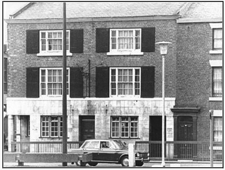
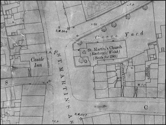
The Castle Inn was located at 42 Nicolas Street, on the corner of Blackfriars and next door to what is now a PC business with the modern Conservative Club above. The area was anciently known as 'St. Martin's Ash' and the medieval church dedicated to that saint may be seen below... Along with an adjoining row of cottages (nos. 30-40 Nicolas Street) it was demolished in 1974 as part of a 'modernisation' of the area following the construction of the Inner Ring Road. The inn's sign has been removed so the photograph may have been taken not long before the pub disappeared. Below we see a detail from the 1875 Chester OS map showing the Castle Inn's location- on the corner of Blackfriars and across the road from Whitefriars and the ancient St. Martin's Church- which, after standing here for a thousand years or so, also vanished in the name of progress when the Nicolas Street stretch of the Inner Ring Road was constructed. Previous to this, this section of the road, where once the west wall of the Roman fortress of Deva ran, was known as St. Martin's Ash. |
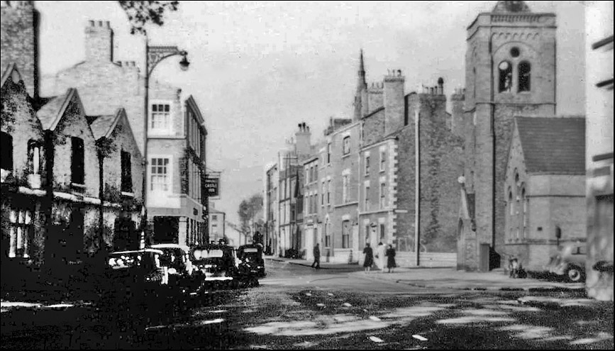
| This fascinating old photograph shows Nicolas Street in the 1950s, before the coming of the Inner Ring Road. On the far left a row of old almshouses stand where the Conservative Club is now. The Castle Inn may be seen just beyond them. All of the fine buildings on the right were demolished to allow for the doubling of the roadway when the Ring Road was created in the early 1960s. One of the casualties was the ancient Church of St. Martin which can be seen on the right. This is one of the very few photographs we've ever seen of the place. |
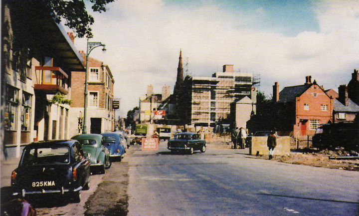
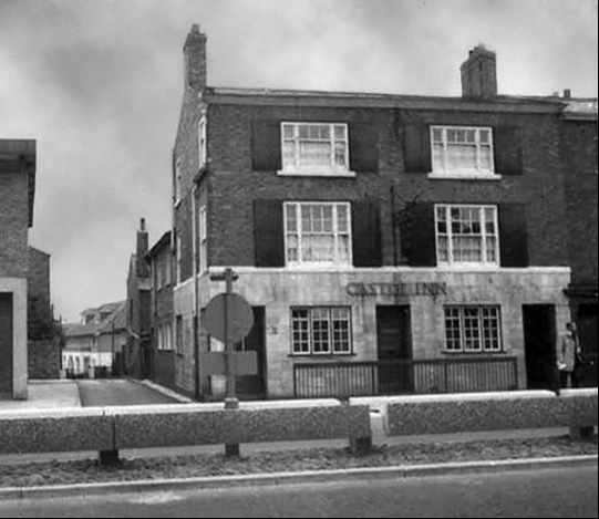
| The same location in 1964- the Castle Inn's sign remains and will give you your bearings. Cuppin Street is on the right. The old church and all of the fine houses have gone, as have the almshouses on the left, and the road is closed to allow new construction and road widening to take place. |
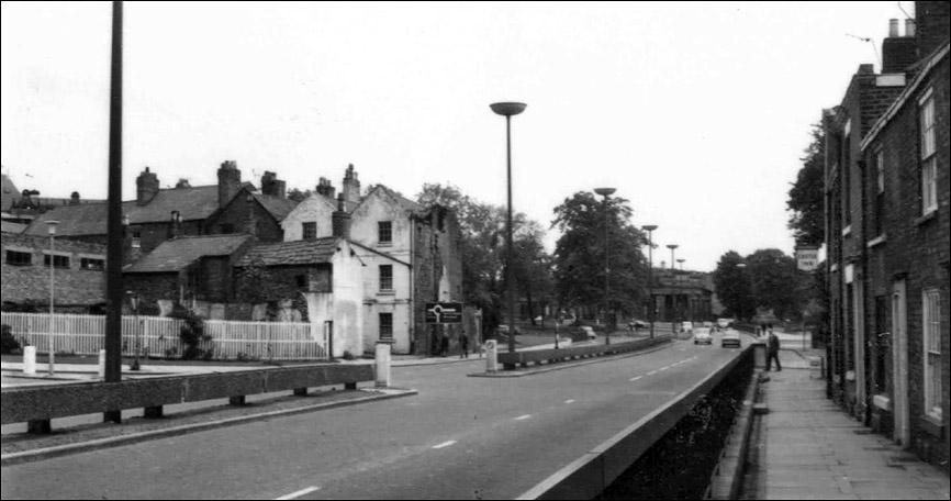
| A decade or so after the photograph above was taken, we see the brand-new Ring Road in place, heading down to the Castle, and wooden fencing closes off the raw wounds of demolished streets and houses. The Castle Inn's sign can be seen on the right. It finally vanished in 1974. |
Do you have any more information about this old pub?
Chester's Vanished Pubs parts 1 | 2 | 3 | 4 | 5 | 6 | 7 | 8 | Gallery | The Chester Inner Ring Road
Site
Front
Door |
Search the site
Index |
Chester
Walls
Stroll | Old Pubs Gallery | Previous Picture | Next Picture