A Virtual Stroll Around the Walls of Chester
The Vanished Pubs of Chester Gallery
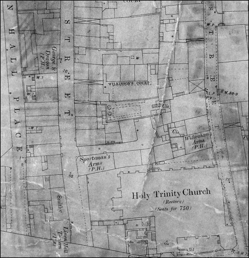
This detail from the 1875 Chester OS map covers the area from Trinity Street on the far right to Linenhall Street and Linenhall Place on the left. Holy Trinity Church- the Guildhall- dominates the bottom of the map. Closest to the church in Trinity Street is The Wilbraham Arms. This was listed in the History, Gazetteer & Directory of Cheshire, 1850 when the licencee was Mrs Ann Bateman, and also in the Post Office Directory of Cheshire in 1856, with Mrs. Bateman still in residence. In 1880 the licencee was Joseph Newnham. Its site today is occupied by a multi-storey car park. The Sportsman's Arms was situated at no. 4 Linenhall Street. Its licencee in 1880 was John Rice O'Hagan, in 1910-1914 William Hughes. The Linenhall Tavern stood on the junction of Lienhall and Watergate Streets. It was recorded in Pigot's Directory as trading here in 1818-20, licencee Jane Britain. She was still the licencee in 1828. Later came Samuel Peacock, who was also a cooper, in 1840-50, James Whitlow in 1880, Henry Peat in 1902. It also appears in this detail from the map. Top left of the map is The George & Dragon (no 21). Pigot's Directory 1818-20 lists the inn, licencee George Walker, as trading in Lower Lane- the former name of Linenhall Street. He was still there in 1840. It also appeared in the 1890 Kelly's Directory of Cheshire. in 1850 the licencee was James Walker, in 1857 W Davies, in 1880 George Simpson. In the 1960s, Linenhall Street vanished beneath the St. Martin's Way stretch of the Inner Ring Road, taking the George & Dragon- and much else- with it. |
Chester's Vanished Pubs parts 1 | 2 | 3 | 4 | 5 | 6 | 7 | 8 | gallery
Site Front Door | Site Index | Chester Walls Stroll | Old Pubs Gallery | Previous Map | Next Map