The
Black & White
Picture
Place
Old Maps and Aerial Photographs of Chester
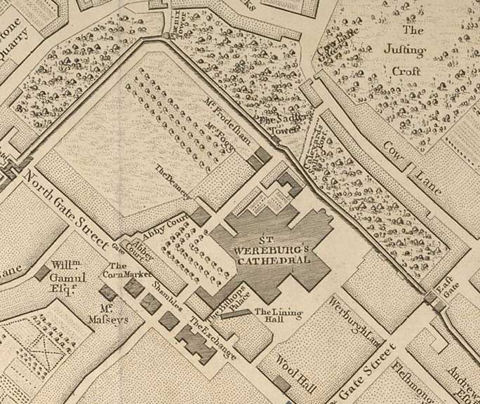
Lavaux's Map of Chester 1745: the Cathedral area
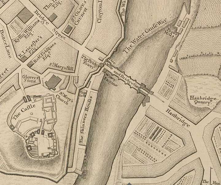
Here are some more details from Lavaux's map of Chester:
|
|
|
|
|
|
|
|
Back to Lavaux's map of Chester
Site
Front
Door
|
Chester
Walls
Stroll
Introduction
|
Old
Maps
&
Aerial
Photographs
|
Site
Index