Chester: a Virtual Stroll Around the Walls
Old Maps and Aerial Photographs of Chester
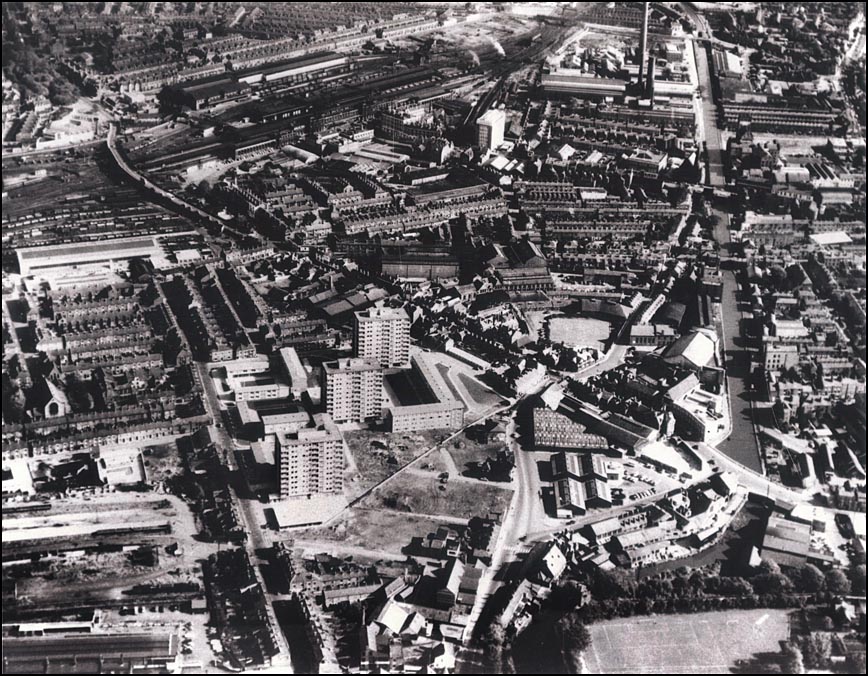
Chester from the Air: Newtown, Looking east c. 1969
|
This
aerial
view
of
the
Newtown
area
of
Chester
shows
a
townscape
in
transition:
the
large
development
of
high-
and
low
rise
flats
is
approaching
completion
but
the
Cattle
Market
to
their
right
is
still
in
place.
This
will
soon
be
demolished
and
replaced
with
a
large
traffic
island
on
the
St.
Oswald's
Way
section
of
the
Inner
Ring
Road-
the
future
line
of
which
may
be
seen
running
diagonally
across
the
cleared
land
in
front
of
the
new
flats.
It
was
opened
in
January
1971.
St. Anne
Street
runs
up
the
left
hand
side
of
the
picture. Go here to see some more photographs of the building of Chester's Inner Ring Road... |
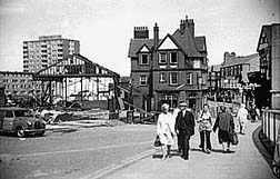
The new flats and demolition of the Cattle Market
On to another aerial photograph of Chester...
Site
Front
Door
| Chester
Walls
Stroll
Introduction
| Old
Maps
&
Aerial
Photographs
| Site
Index